


Why Google Cloud
Why Google Cloud

Scale with infrastructure built for performance
Citadel Securities accelerates quantitative research 2-4x faster at 30% less cost with Google Cloud TPUs.

Turn fragmented customer service into seamless journeys
The Home Depot drives higher conversion rates from inspiration to installation with Gemini Enterprise for Customer Experience.

Empower your crew with a world-class AI assistant
Virgin Voyages uses Gemini Enterprise on Google Distributed Cloud Edge to deliver instant, personalized service regardless of satellite connectivity.

Innovate smartly with an integrated AI stack
Unilever connects agents end-to-end so procurement teams can make faster, smarter sourcing decisions on a secure foundation.


Product Category
- AI and Machine Learning
- API Management
- Compute
- Containers
- Data Analytics
- Databases
- Developer Tools
- Geospatial and Maps
- Google Workspace
- Networking
- Operations
- Security and Identity
- Serverless Computing
- Storage
- Other
Industry
- Automotive
- Education
- Financial & Insurance Services
- Gaming
- Government & Public Sector
- Healthcare
- Life Sciences
- Manufacturing
- Media & Entertainment
- Retail & Consumer Goods
- Startup
- Technology
- Telecommunications
- Transportation
- Other
Region
- Asia Pacific & Japan
- Europe, Middle East & Africa
- Latin America
- U.S. & Canada
- AI and Machine Learning
- API Management
- Compute
- Containers
- Data Analytics
- Databases
- Developer Tools
- Geospatial and Maps
- Google Workspace
- Networking
- Operations
- Security and Identity
- Serverless Computing
- Storage
- Other
- Automotive
- Education
- Financial & Insurance Services
- Gaming
- Government & Public Sector
- Healthcare
- Life Sciences
- Manufacturing
- Media & Entertainment
- Retail & Consumer Goods
- Startup
- Technology
- Telecommunications
- Transportation
- Other
- Asia Pacific & Japan
- Europe, Middle East & Africa
- Latin America
- U.S. & Canada
Product Category
Industry
Region
- Relevance
- Newest
- Title A-Z
 "Etsy creates personalized experiences for its 90 million shoppers by using Vertex AI (now Gemini Enterprise Agent Platform), BigQuery, Dataflow, and Gemini models to better understand inventory, customer intent, and individual buyers."
 Aible rapidly deploys trusted generative AI agents aligned with core business KPIs. Leveraging NVIDIA's airgapped hardware and co-optimized GPU stacks with Google Cloud's serverless BigQuery and Cloud Run, Aible delivers secure, scalable AI impact within 30 days.
 Shopify uses Claude on Agent Platform to scale Sidekick, an AI-enabled commerce assistant, to make it easier for millions of merchants to get more done faster.
 Proforce built a Google Cloud foundation from day one to operate smarter, serve more customers, and scale across 13 markets.
 "A concept we're embracing as an organization is having digital co-workers, enabled by Gemini Enterprise. It makes sense as the next step in incorporating AI as an integral part of how we work."
 With Gemini Enterprise, Mars is automating core business processes, empowering associates to work faster and more creatively.
 FlutterFlow set out to remove the technical barrier between builders and their products. Firestore became the foundation that let the company scale from zero to 3.4 million builders while serving more than 750 billion reads without outages for five years.
 TELUS built its generative AI platform, Fuel iX™, on Google Cloud and used BigQuery to unify its data ecosystem and build an agentic AI-ready platform for proactive problem-solving and increased trust in data companywide.
- Shopify empowers entrepreneurs globally, from ideation to IPO. Using Google Cloud, it now pioneers agentic commerce, developing the Universal Commerce Protocol and AI-powered assistants to fuel its mission of creating more entrepreneurship.
 Picsart democratizes visual content with intuitive, AI-powered photo and video editing tools for billions. Leveraging Google Cloud, Gemini Enterprise Agent Platform, and Gemini models, they seamlessly scale and rapidly deploy advanced automated editing features.
 Suffolk County partnered with Google Public Sector and UVS InfoTech to deploy the Civic Oriented Response Assistant (CORA), an AI-powered virtual voice agent that automates complex workflows, handles high-volume call surges, and delivers secure, 24/7 multilingual assistance to 1.5 million residents.
 Grocery retailer Albertsons Companies checked data unification off its list with BigQuery, then applied Gemini Enterprise Agent Platform and Vision AI to automate product quality inspections. The result: piping-hot data insights to improve the supply chain, better business decision-making, and fresher produce for customers.
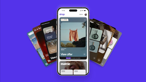
 Multi-brand retailer URBN chose Google Cloud to empower employee creativity and serve shoppers globally with great experiences.


Learn what industry analysts are saying about Google Cloud
Explore analyst reportsNetwork with other professionals
Join the Google Cloud community
Ask about Google Cloud
- Clear conversation
- replyDiscover solutions for my industry
- replyHow do companies use Gemini Enterprise?
- replyTell me 5 innovative things customers do with Google Cloud