Google Cloud for transportation
Go global with a unified AI-optimized tech stack. Leverage the power of Google Cloud for massive scale with products like BigQuery for deep logistics insights, then execute locally via platforms like Google Maps and Waze to manage the "last mile" of any product delivery or citizen journey.
With broad reach across Google Maps, AI, and Cloud, Google empowers partners to tackle the toughest transportation challenges. We co-create mission-driven solutions that lead to safer, more resilient, and efficient systems for citizens and communities worldwide.
Putting intelligent operations on autopilot
AI and Generative AI are transforming public service. Leverage Google's integrated AI stack including Gemini Enterprise Agent Platform (formerly Vertex AI) to build solutions that help create a safer, more efficient and more resilient transportation system.
“We saw Google as a robust, best-in-class solution that provides that turnkey tool for the CTA. The Chat with CTA chatbot created a new, innovative tool for our Agency to leverage as we continue to evolve our approach to rider communications.”
Molly Poppe, Chief Planning & Innovation Officer, Chicago Transit Authority
Explore AI at Google
The trusted foundation for your critical systems
Power your operations with secure, scalable, and customizable platforms. This includes Google Maps Platform for real-time mobility services, Google Cloud infrastructure for data processing, and Workspace with Gemini for seamless collaboration across your agency.
“We decided to build a solution that would work on touchscreen kiosks and mobile devices to detect visitors' locations and give them interactive walking directions in real time… We chose Google Maps and Google Maps Platform to do it because Google offers a familiar interface for our customers, lets us layer custom information on top of maps and provides a platform that will allow us to add new features, like delivering relevant, location-based ads.”
Chris Shirer, President and Chief Strategist, Madison + Fifth
Explore platforms at Google
Unlocking insights from every data point on the map
Transportation systems generate enormous data volumes from telematics, sensors, and cameras. Use BigQuery, Google’s serverless data warehouse, to quickly ingest and analyze petabytes of data, combining sources like Waze and NOAA for real-time operational and strategic decision-making.
“Applying data science at scale to cities has so much potential. Cities have data across all the departments; they just need the right set of computation resources, and familiarity with processing data at that scale.”
Abhishek Dubey, Associate Professor of Electrical Engineering and Computer Science at Vanderbilt University
Explore data at Google
Translating technology into real-world solutions
Leverage proprietary models like Mobility AI for transportation planning, from traffic flow optimization to demand prediction. Google offers a unified AI platform with proprietary, 3rd party, and open-source models, extending from the Cloud core to the mobile edge for every use case.
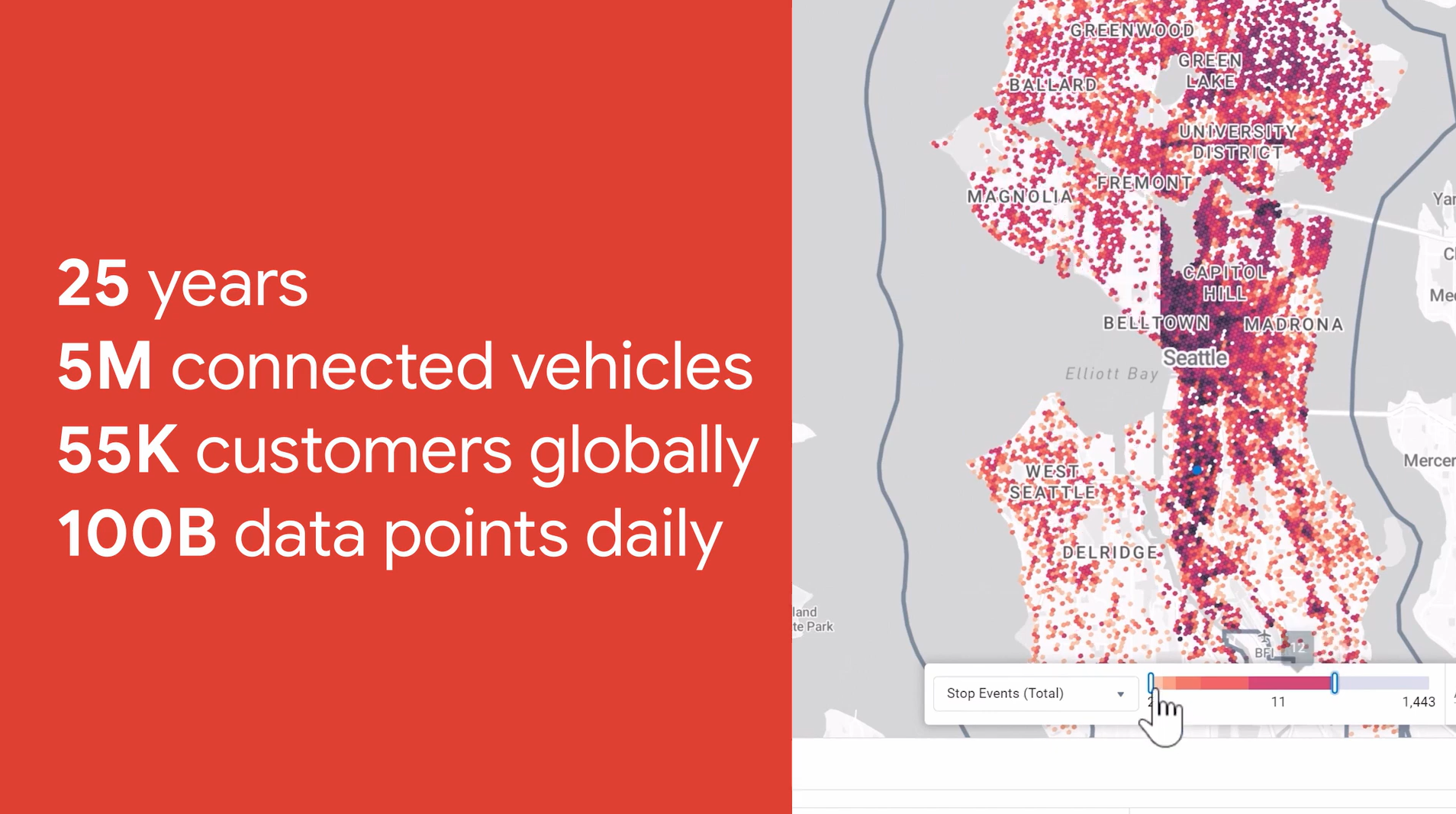
“There’s no question that BigQuery is more cost-effective than buying servers. With $10 worth of queries, we can do what would cost $20,000 of engineering and labor in the field. This is a real game-changer for using CAV data to provide agencies with actionable information for improving the safety and efficiency of their transportation systems.”
Darcy Bullock, Director, Joint Transportation Research Program, Purdue University
From labs to roads: The science behind smarter transit
Google Research translates cutting-edge advancements into core technologies that underpin real-world solutions, including advanced mapping, routing, and traffic prediction algorithms. This commitment drives solutions for urban transportation and operational efficiencies.
“Research runs on tight timelines and a complex constellation of partnerships. Google Cloud is ready to step up to the challenge, continuously developing new solutions that give us the flexibility and security we need to keep research running.”
Sean Dudley, Associate Vice President, Arizona State University
Explore research at Google
Connect multiple Google Earth models with Geospatial Reasoning to deepen your research impact
Learn about Google Earth AI
Future-proof each step of your transportation systems from policy-making, launching, and monitoring
Explore Mobility AI
Deepen your understanding with Google Deepmind: AI Research Foundations
Expand your skills
AI
Putting intelligent operations on autopilot
AI and Generative AI are transforming public service. Leverage Google's integrated AI stack including Gemini Enterprise Agent Platform (formerly Vertex AI) to build solutions that help create a safer, more efficient and more resilient transportation system.
“We saw Google as a robust, best-in-class solution that provides that turnkey tool for the CTA. The Chat with CTA chatbot created a new, innovative tool for our Agency to leverage as we continue to evolve our approach to rider communications.”
Molly Poppe, Chief Planning & Innovation Officer, Chicago Transit Authority
Explore AI at Google
Platforms
The trusted foundation for your critical systems
Power your operations with secure, scalable, and customizable platforms. This includes Google Maps Platform for real-time mobility services, Google Cloud infrastructure for data processing, and Workspace with Gemini for seamless collaboration across your agency.
“We decided to build a solution that would work on touchscreen kiosks and mobile devices to detect visitors' locations and give them interactive walking directions in real time… We chose Google Maps and Google Maps Platform to do it because Google offers a familiar interface for our customers, lets us layer custom information on top of maps and provides a platform that will allow us to add new features, like delivering relevant, location-based ads.”
Chris Shirer, President and Chief Strategist, Madison + Fifth
Explore platforms at Google
Data
Unlocking insights from every data point on the map
Transportation systems generate enormous data volumes from telematics, sensors, and cameras. Use BigQuery, Google’s serverless data warehouse, to quickly ingest and analyze petabytes of data, combining sources like Waze and NOAA for real-time operational and strategic decision-making.
“Applying data science at scale to cities has so much potential. Cities have data across all the departments; they just need the right set of computation resources, and familiarity with processing data at that scale.”
Abhishek Dubey, Associate Professor of Electrical Engineering and Computer Science at Vanderbilt University
Explore data at Google
Models
Translating technology into real-world solutions
Leverage proprietary models like Mobility AI for transportation planning, from traffic flow optimization to demand prediction. Google offers a unified AI platform with proprietary, 3rd party, and open-source models, extending from the Cloud core to the mobile edge for every use case.
“There’s no question that BigQuery is more cost-effective than buying servers. With $10 worth of queries, we can do what would cost $20,000 of engineering and labor in the field. This is a real game-changer for using CAV data to provide agencies with actionable information for improving the safety and efficiency of their transportation systems.”
Darcy Bullock, Director, Joint Transportation Research Program, Purdue University
Research
From labs to roads: The science behind smarter transit
Google Research translates cutting-edge advancements into core technologies that underpin real-world solutions, including advanced mapping, routing, and traffic prediction algorithms. This commitment drives solutions for urban transportation and operational efficiencies.
“Research runs on tight timelines and a complex constellation of partnerships. Google Cloud is ready to step up to the challenge, continuously developing new solutions that give us the flexibility and security we need to keep research running.”
Sean Dudley, Associate Vice President, Arizona State University
Explore research at Google
Connect multiple Google Earth models with Geospatial Reasoning to deepen your research impact
Learn about Google Earth AI
Future-proof each step of your transportation systems from policy-making, launching, and monitoring
Explore Mobility AI
Deepen your understanding with Google Deepmind: AI Research Foundations
Expand your skills
Customer stories
From the U.S. Department of Transportation to Formula E, organizations across the country are partnering with Google to create safer, more resilient, and more efficient transportation systems. Explore their stories and see what’s possible.
- U.S. Department of Transportation selects Google Workspace as new agency-wide collaboration suite.
3-min read
- Chicago Transit Authority connects with city: AI chatbot bridges language barriers and empowers riders.
4-min read
- Central Texas Regional Mobility Authority: Building the road ahead with Google AI.
3-min read
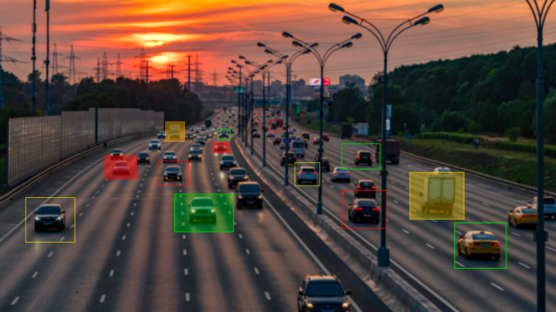
Safety and reliability
Safety means securing every vehicle, asset, and mile of the network. We integrate Maps, AI, and data to deliver continuous protection: real-time maintenance for fleets, overheight strike prevention, and critical safety alerts for workers and public travelers.


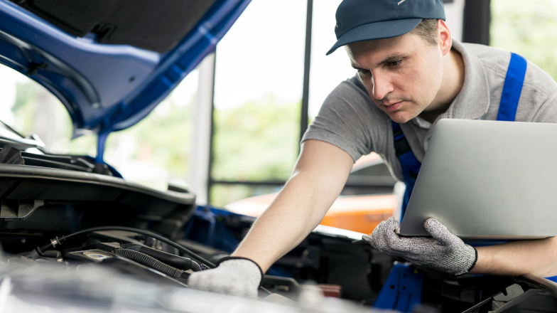 From rail inspection to fleet health: Predictive maintenance with AI and visionMonitor asset health and predict component failures for rail lines, bridges, and vehicle fleets before major issues occur.
 Offer seamless, 24/7 support in multiple languages to ensure every rider feels heard and safeBreak down language barriers and increase transit equity with an AI virtual assistant supporting the diverse needs of your entire community.
Resilient infrastructure
Secure your critical assets from all environmental and operational threats. Google delivers the intelligence for resilient infrastructure and fleets: real-time flood monitoring, predictive weather modeling, and evacuation planning to protect people and high-value physical assets.
 Prepare for uncertain events such as natural disastersSee how Hawaii DOT uses climate data and AI to build a Climate Resilience Platform to assess risk and prioritize investment.
 Use deep-learning models to map growing cities and identify infrastructure gaps in real timeTransform urban planning with automated asset detection that identifies everything from building footprints to street signs with pinpoint accuracy.
 Synthesize vast research libraries into actionable roadmaps with grounded AI intelligenceDrive infrastructure innovation by using AI to identify trends and patterns across years of historical reports and environmental studies.

Seamless operations
Gain real-time control over your entire network, from curb to rail. Our solutions manage traffic anomalies, digitize rights-of-way, integrate agency data into Maps for alerts, and ensure predictable transit and special event management.
 Predict your next move from maintenance to metrosExplore how MTA increases safety, reliability, and efficiency with sensor application, proactive analysis and defect detection, and inspection process optimization.
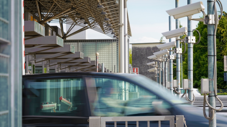 Modernize tolling and enforcement with AI-powered video analyticsIncrease revenue capture and reduce evasion by applying AI to detect violation events on bus lanes or toll roads.
 From rail inspection to fleet management: predictive maintenance with AIMove beyond reactive repairs. See how to monitor asset health and predict failures for rail and vehicle fleets.
 Delivering a seamless transit and tolling experience with Google WalletIntegrate secure digital payments, ticketing, and passes into one mobile wallet for riders and travelers.
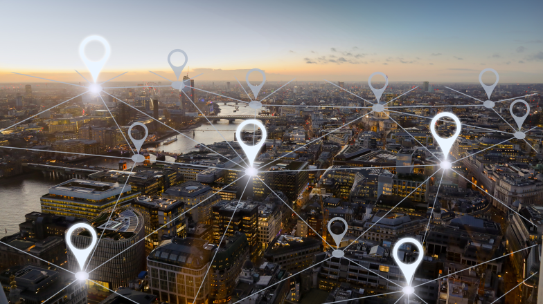 Optimize every mile: AI-powered routing to solve complex logistics and reduce fuel costsUse AI and real-time Maps data to optimize fleet routes, predict accurate ETAs, and significantly reduce fuel consumption.
 Enhance operational safety by breaking down silos with real-time editing and shared cloud dataModernize your workflows and increase productivity with Google Workspace across apps with no knowledge lost.
Growth and planning
Build the future of your fleet, network, and infrastructure confidently. We help transportation leaders plan for the next decade by leveraging historic Maps data, AI-driven demand forecasting, and tools to accelerate grant and procurement management.
 Build the future of your fleet, freeway, or freightUsing Google Maps historic data to inform the future of how we move.
 Accelerate grant management and procurement: AI for document reviewDramatically speed up the review of complex federal documents like STIPs, TIPs, and grant applications.
 Plan for complex energy landscapes by turning fragmented data into actionable strategic intelligenceUnlock the potential of energy data to predict market shifts, lower operational costs, and drive long-term strategic growth.
Join the agencies building the future of transportation


A network of experts, ready to help
Our trusted industry partners bring deep transportation expertise to help your organization navigate every stage of digital transformation. They are an essential part of our commitment to delivering complete solutions that meet your organization’s vision to keep people and products moving.