
15% increase in driver trip acceptance rates
25% reduction in average pickup times
540 hours of waiting time saved each month
30% to 40% drop in customer complaints
By implementing Google Maps Platform Mobility services for traffic-aware routing, UBCab reduced average pickup times by 25% to ensure riders in the world's coldest capital aren't left waiting outside.
By implementing Google Maps Platform Mobility services for traffic-aware routing, UBCab reduced average pickup times by 25% to ensure riders in the world's coldest capital aren't left waiting outside.

Overcoming extreme winter weather challenges with traffic-aware routing
In Ulaanbaatar, Mongolia—the world’s coldest capital city—winter temperatures frequently plunge to minus 40 degrees Celsius. When booking a ride-hailing service in such extreme cold, people can’t afford to stand outside waiting. They need to know their car will arrive on time. That’s why over 80% of Mongolia’s adult population depend on UBCab, which uses Google Maps Platform to ensure its 1.5 million ride-hailing customers aren’t left out in the cold.
Before implementing Google Maps Platform Mobility services, however, UBCab faced technical limitations with its automated driver matching system, which relied on straight-line distance calculations to find nearby drivers. Because this calculation didn’t account for actual road layouts or heavy traffic jams, the system sometimes assigned drivers who were physically close on a map but separated by long driving routes or congested intersections. This led to longer pickup times, driver trip rejections, and fluctuating estimated times of arrival (ETAs) that could lead to customer complaints. Drivers, meanwhile, had to switch between the UBCab app and external navigation apps to check traffic conditions and map out their routes. To solve these routing challenges and give riders predictable ETAs, UBCab turned to Google Maps Platform Mobility services.
Matching drivers using a straight line on a map meant the system did not understand live traffic or actual road layouts. By adopting Google Maps Platform Mobility services, we can match riders with the nearest driver based on real driving time, giving riders dependable arrival times and drivers much better routes.
Erdem Batsaikhan
CTO and Co-founder, UBCab
“Matching drivers using a straight line on a map meant the system did not understand live traffic or actual road layouts,” explains Erdem Batsaikhan, CTO and co-founder at UBCab. “By adopting Google Maps Platform Mobility services, we can match riders with the nearest driver based on real driving time, giving riders dependable arrival times and drivers much better routes.”

Improving driver and rider experiences with Google Maps Platform Mobility services
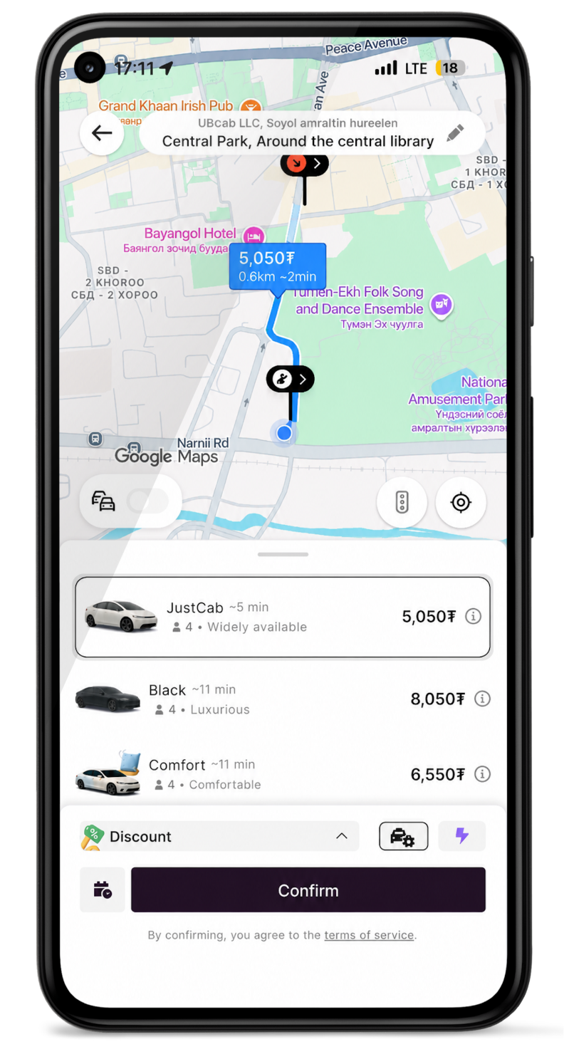
Working alongside Google Cloud partner Master Concept, UBCab integrated Mobility services directly into its core dispatch engine. Using Compute Routes within the Routes API, the company replaced straight-line matching with live, traffic-aware routing to solve its core challenge of unpredictable arrival times. The API evaluates real-time traffic data and road geometry to calculate actual driving duration before assigning a ride. This ensures drivers receive trip requests they can reach quickly, while riders receive accurate ETAs and fair price estimates calculated from actual driving conditions.
Our city has many areas without standard street addresses. Google Maps Platform provides the foundational roads, live traffic, and routing. Combining that with our own local knowledge helps our drivers pinpoint the exact pick-up location every time.
Erdem Batsaikhan
CTO and Co-founder, UBCab
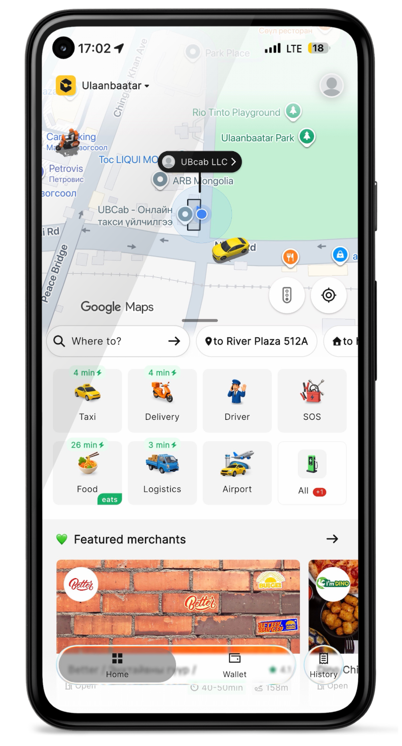
With the routing optimized, the company wanted to further refine the experience for the drivers themselves. Previously, drivers had to check external apps for directions requiring to leave the driver app, so UBCab used the Navigation SDK to bring turn-by-turn guidance directly into its own app, eliminating the need for drivers to switch between multiple applications while navigating the city. To make the feature fully accessible, UBCab custom-developed Mongolian voice guidance for the SDK. This in-app guidance helps newly registered drivers navigate unfamiliar urban routes safely while keeping their eyes on the road.
Even with optimized routes and turn-by-turn navigation, drivers still need a precise destination. Because parts of Ulaanbaatar lack formal or consistent street addresses, simply navigating to a traditional street name is not always possible. To ensure drivers do not get lost in these areas, UBCab overlaid its own proprietary addressing system onto the Google Maps base map. By combining local address points with Google Maps Platform routing and traffic data, UBCab enables drivers to locate precise pickup spots every time.
“Our city has many areas without standard street addresses,” notes Batsaikhan. “Google Maps Platform provides the foundational roads, live traffic, and routing. Combining that with our own local knowledge helps our drivers pinpoint the exact pick-up location.”
Integrating Mobility services has completely transformed our dispatch efficiency. As we expand our package delivery offering and adopt visual positioning for international tourists, Google Maps Platform gives us the technology we need to deliver fast, modern services to every city and town in Mongolia.
Erdem Batsaikhan
CTO and Co-founder, UBCab
Scaling nationwide services and international experiences with Google Maps Platform
The adoption of Google Maps Platform Mobility services has created significant improvements across UBCab's operations. Driver trip acceptance rates have increased by 15%, while average pickup times fell by one minute—a 25% reduction that saves Mongolian riders a collective 540 hours of waiting time every month. As a result of these improvements, customer complaints regarding prices and arrival times dropped by 30% to 40%, reducing the amount of time the call center team spends handling calls.
Building on this success, UBCab plans to extend Mobility services to its food delivery and express package delivery lines. The company is also preparing to implement advanced Google Maps Platform capabilities, such as Grounding with Google Maps for camera-based positioning, 3D mapping, and visual street name recognition. These tools will help the 1 million international tourists visiting Mongolia each year easily identify pick-up points and navigate cities without language barriers. By continuously adopting new Google Maps Platform features, UBCab is building a highly accurate, location-aware ecosystem that will support its expansion into new delivery markets and tourist services, laying the technological groundwork for the future of smart transportation in Mongolia. Beyond maps, UBCab is also planning to expand its Google collaboration by integrating Gemini for business, leveraging generative AI to automate dispatch workflows and predict operational disruptions across our growing fleet.
“Integrating Mobility services has completely transformed our dispatch efficiency,” concludes Batsaikhan. “As we expand our package delivery offering and adopt visual positioning for international tourists, Google Maps Platform gives us the technology we need to deliver fast, modern services to every city and town in Mongolia.”
UBCab is a leading Mongolian technology company providing efficient passenger transportation, express delivery, and logistics solutions to 1.6 million users nationwide.
Industries: Travel and Hospitality, Startup
Location: Mongolia
Products: Google Maps Platform, Mobility services, Navigation SDK, Routes API
About Google Cloud partner – Master Concept
Master Concept is an award-winning Google Cloud partner providing cloud implementation, mobility solutions, and digital transformation services.