Deploys a real-time risk-scoring engine in just seven weeks
Provides dispatchers and technicians with additional location-specific risk information
Supports more informed roadside-service decisions across The Auto Club Group’s member base
Provided 6.5k+ active work orders with expanded risk insights
The Auto Club Group uses Google Maps Platform to assess real-time roadside hazards and improve technician and driver safety.
The Auto Club Group uses Google Maps Platform to assess real-time roadside hazards and improve technician and driver safety.
Minimizing the dangers of roadside service for thousands of technicians
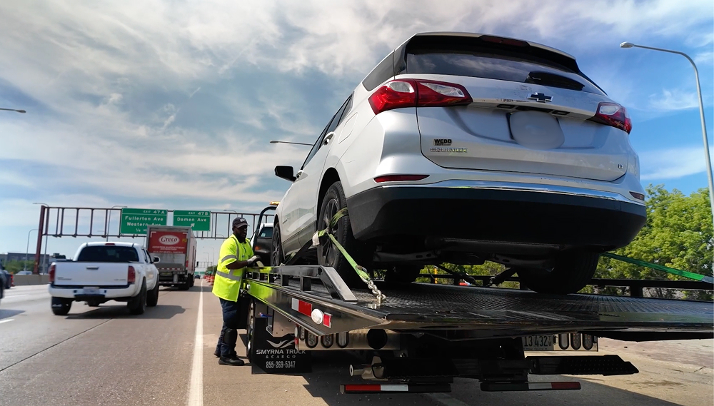
It’s no surprise that busy roadsides make for hazardous—and sometimes even deadly—workplaces. Roadside service work can expose technicians to significant hazards from passing traffic, limited visibility, weather, and changing road conditions. For The Auto Club Group (ACG), the second-largest AAA club in North America, protecting its 9k+ field technicians is a deeply personal mission. “You can’t put a price on peoples’ lives,” says Scott VerBracken, Vice President Automotive Services at AAA - The Auto Club Group. “We’re always working to contribute to AAA's overall mission of safety both for members and our technicians.”
For decades, these field technicians have had access to basic routing and coordinates with some degree of risk insight. Highway incidents were labeled high-risk locations while street-level jobs were deemed lower risk. This system didn’t take into account the dynamic changes of actual road conditions such as time of day, visibility, or traffic flow. The Auto Club Group recognized that to truly protect its technicians, it needed to capture real-time conditions at the exact breakdown location.
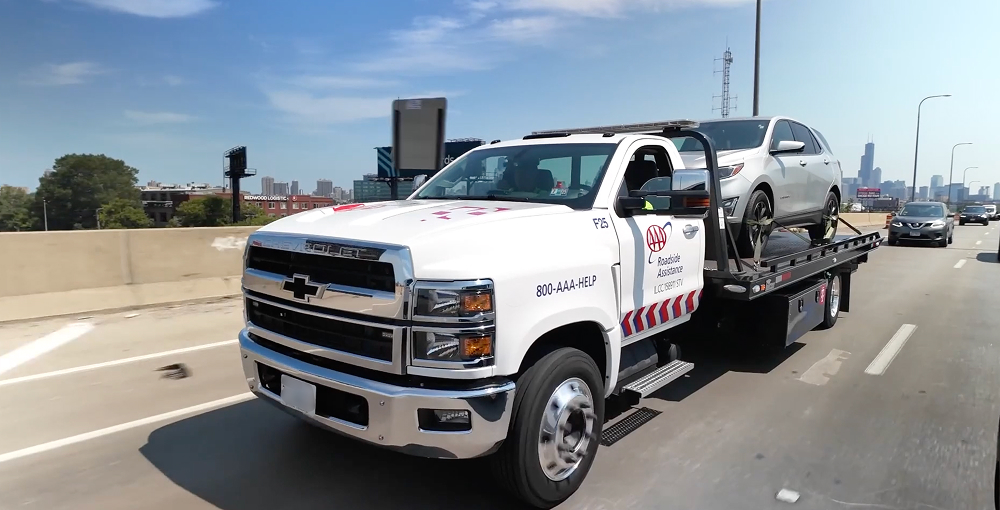
In The Auto Club Group’s plan to transform roadside safety, the team needed to be able to ingest large amounts of real-time traffic and weather data. These complex datasets then needed to be translated into an easy-to-read message that shared relevant information with technicians. It also wanted to connect these outputs to the technicians’ existing Salesforce app to ensure the team didn’t need to purchase or download additional apps.
Lastly, the company’s new solution had to be easily scalable, so they could share this new, safer solution with more drivers and other auto clubs as quickly as possible. “We want to equip our technicians with industry best insights that will keep them and our members safe,” Kevin Alberta, Assistant Vice President of Business Technology at AAA - The Auto Club Group. “To do that, we need best-in-class companies like Google Maps Platform and Woolpert that are on the leading edge of innovation, data, and mobility.”
We want to equip our technicians with industry best insights that will keep them and our members safe. To do that, we need best-in-class companies like Google Maps Platform and Woolpert that are on the leading edge of innovation, data, and mobility.
Kevin Alberta
Assistant Vice President of Business Technology and Transformation, AAA - The Auto Club Group
Scaling a risk-scoring engine powered by decades of data
The Auto Club Group architected a unified data lake using Google Cloud and BigQuery to aggregate, analyze, and act on its data. These datasets are a combination of extensive internal records and information collected through Google Maps Platform solutions including the Places, Geocoding, and Weather APIs and Roads Management Insights (RMI). The Auto Club Group teamed up with Woolpert to turn all of this information into a real-time risk assessment tool in just seven weeks. “This solution was a truly collaborative effort,” VerBracken says. “Our team brought the roadside expertise, Google knows data and technology, and Woolpert helped us turn very complex datasets into simple, readable outputs.”
This solution was a truly collaborative effort. Our team brought the roadside expertise, Google knows data and technology, and Woolpert helped us turn very complex datasets into simple, readable outputs.
Scott VerBracken
Vice President Automotive Services, AAA - The Auto Club Group
The new solution uses Places and Geocoding APIs to identify member locations at the exact location of the road service event, Weather API to score visibility based on time of day, and RMI for granular traffic speed and routing. The tool combines location, traffic, weather, and historical service data to assess risk at the precise service location, giving technicians and dispatchers clearer information to make more informed safety decisions. “We can access more precise information reviewing 30 one-mile stretches of highway than we could doing one 30 mile,” Alberta says. “If, for example, we know that mile 15 is a common area for crashes, but there’s an off-ramp a few miles down the road, we can now tell the driver to tow the vehicle to the safer area.”
All of this information is shared with dispatchers and drivers through a three-tiered risk assessment that also helps determine what tools or vehicles may be the safest option for a given scenario. For "High" scores caused by poor visibility, for example, the system prioritizes dispatching trucks equipped with safety countermeasures like high-visibility reader boards.
Improving road technician safety measures across the country
Since deploying the risk assessment solution to the Detroit metropolitan area, the team has already processed more than 11,800 work orders. Technicians ranging from new responders to veteran drivers have shared an appreciation for the additional insights giving them first-time tips or revealing overlooked hazards. “Even if a driver has taken a single route 100 times, there’s no way they’ve taken it in every possible condition,” Alberta shares. “I can sleep better at night knowing I’ve given those technicians an even better chance to make it through their shift safely.”
Following this initial rollout, The Auto Club Group plans to expand the Michigan deployment to include Grand Rapids. By the end of 2027, the team is aiming to share the solution with all major metro areas across its 14-state region and 4M+ annual service calls while adding additional data points such as shoulder depth and weather forecasting. The Auto Club Group is exploring opportunities to share appropriate learnings and implementation resources with other AAA clubs, subject to applicable agreements, intellectual-property rights, security requirements, and separate approval by the participating organizations. “Any organization that provides field service has the same objectives: keep their workers safe on the job,” VerBracken adds. “I would love to see this solution reach more auto clubs and even other industries, so that everyone has additional safety tools on hand.”
Any organization that provides field service has the same objectives: keep their workers safe on the job. I would love to see this solution reach more auto clubs and even other industries, so that everyone has additional safety tools on hand.
Kevin Alberta
Assistant Vice President of Business Technology and Transformation, AAA - The Auto Club Group
The Auto Club Group (ACG) provides 14M+ members with roadside assistance, auto and home insurance, travel planning, and financial services.
Industry: Travel and Hospitality, Transportation
Location: United States
Products: BigQuery, Geocoding, Google Maps Platform, Places API, Roads Management Insights, Weather API
About Google Cloud partner – Woolpert
Woolpert is a geospatial technology and Google Cloud partner that helps modernize applications, optimize workflows, and unlock location insights.