Practicing the science of where with Esri ArcGIS on Google Cloud

Denise Pearl
Global GTM Practice Lead, Sustainability, Google Cloud
Kelsey Hightower
Principal Engineer
For the past 18 years Google has been working to organize the world’s information and make it universally accessible and useful. Today, much of the data being generated is location-aware and the questions people are asking center on “where.” Where can I be tested for COVID-19? Where is early voting? Where is there a coffee shop near me?
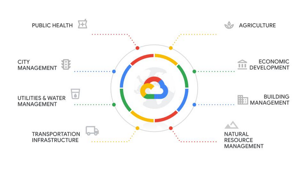
We see that trend in business too, and at Google Cloud, we’re focused on enabling the use of geospatial data in your organization. Government agencies may have led the charge on the development and deployment of Geographic Information Systems (GIS) mapping, but as data analytics becomes more embedded in enterprise workflows, other industries including healthcare, retail, financial services, media & entertainment and manufacturing are embracing the use of location-aware data sets to inform key business decisions.
Geospatial data allows organizations to create digital versions of the physical world around them to inform actions on research, supply chain and built infrastructure such as roads and bridges. New data science teams are being established within corporations large and small and their entry to geospatial data is often via analytics tools versus traditional GIS products. The ability to run Esri ArcGIS Enterprise on Google Cloud provides a bridge between the two.
Esri has been the cornerstone GIS application globally for over five decades, and hundreds of thousands of organizations leverage the Esri platform to visualize information within maps. And by running Esri on Google Cloud, specifically Esri ArcGIS Enterprise, you can take advantage of several advanced Google Cloud services.
At a basic level, you can run Esri ArcGIS Enterprise, Portal, WebAdapter, Image Server or Tile Cache and Datastore on Google Cloud on standard Compute Engine virtual machine instances, on either Linux or Windows operating systems. Compute Engine makes it easy to create and configure high-performance virtual machines that scale quickly and easily to any sized workload, while using Google’s worldwide, high-speed network. With custom machine types, you can configure the number of virtual CPUs (vCPUs) and RAM in each of your VMs, for significant cost savings compared with predefined amounts of vCPU and memory. Similarly, Compute Engine VMs aren’t bundled with a solid-state disk (SSD), so you don't have to buy larger VMs than you need to get your required SSD.
To deploy ArcGIS Enterprise you can leverage automated deployment tools like PowerShell DSC and Chef Automation. Further, a significant number of ArcGIS Enterprise deployments that are moving to Google Cloud are Window Server-based. Google Cloud offers a first-class experience for Windows- and Microsoft-based workloads with enterprise-grade support. To ensure no disruption in your current infrastructure hierarchy management, you can federate Active Directory with the Google Cloud Directory Sync service, or use Managed Service for Microsoft Active Directory. Additionally, you can invoke Google Cloud load balancers, managed SSL certificates, managed databases (SQL Server and Postgres) and the NoOps serverless data warehouse BigQuery, all of which are compatible with Esri ArcGIS Enterprise.
Google Cloud customers that choose BigQuery as their analytics framework enjoy a platform that’s capable of tremendous scale. We have customers with data volumes in excess of hundreds of petabytes, that run queries that scan tens of PBs, that stream gigabytes per second per table, and that run tens of thousands of concurrent queries. Meanwhile, organizations looking for an open, enterprise-ready, reliable, easy-to-use and secure database rely on Cloud SQL. BigQuery and Cloud SQL are tightly integrated, and both have first-class support for geospatial data types and functions. Users of PostGIS will feel right at home with both of these services.
As an ArcGIS user, you can access data in BigQuery from a Python notebook using the Google Cloud SDK and then write that data to ArcGIS Enterprise web services through a feature service or use it as inputs to your own geoprocessing workflows. Google Cloud also offers Safe Software’s FME ETL tool to provide data interoperability between various geoprocessing workflows.
Then, once your data is in Google Cloud’s suite of analytics solutions, you can apply Google Cloud AI/ML capabilities to questions like land use, infrastructure condition, and environmental changes. We believe that using AI with geospatial data will have the power to fundamentally change the way communities invoke policy and drive investment in the areas where they work, live and thrive.
"Esri on GCP is the perfect match for organizations looking to evolve their spatial data infrastructure by using truly unique geospatial capabilities from the most scalable public cloud service in the world." -Nathan Eaton, Executive Director, NGIS
What’s next
GIS has evolved from being used by a single department to build static maps to a foundational element of business process automation and innovation. The combination of Google Cloud’s data analytics tooling and Esri ArcGIS Enterprise offers unique opportunities for users to reimagine geoprocessing workflows and take advantage of big data. Stay tuned for future posts we will highlight specific analytics and machine learning examples leveraging the geospatial offerings within Google Cloud in combination with Esri ArcGIS Enterprise.
To learn more about running Esri applications with Google Cloud, please reach out to your Google Cloud partner or representative.